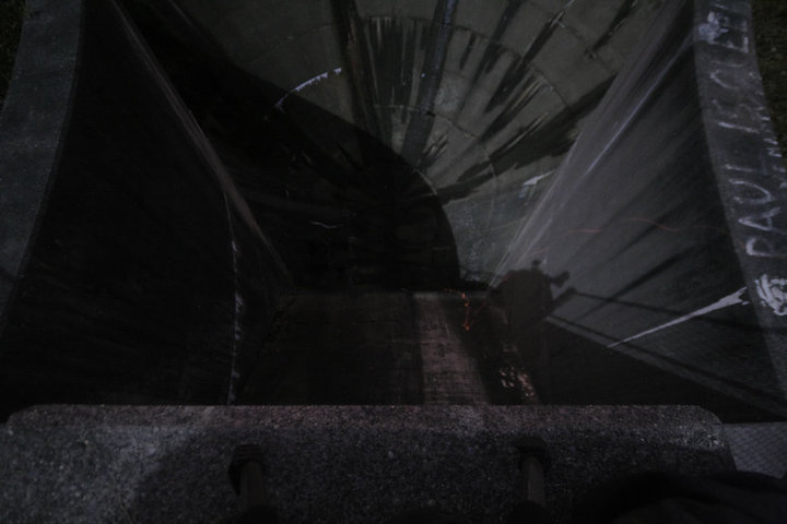
James Ascent and I set out around 11pm for our trip. Our method of getting to the bottom was the safest of the three, the rappelling. James gave me a 5 minute crash course on rappelling, and over the ledge I went, wanting to be the first into the belly of this massive beast. Slowly, i made my way down, shaking like a leaf the entire time. After what felt like 30 minutes, but was really only about 3, my feet made contact with the ground on the bottom of the GloryBowl. I unharnessed myself, and sent the gear back up to James. After a few minutes, James was with me in the center if the bowl, just staring intently all around us, in awe. Now, we had conquered the beast and the only thing left to do was photograph her and have a blast running around inside the 20' drain. My batteries died really soon after our descent, because I'd used them all morning during the Ninja Turtles Event, but photography can always happen again. This trip, I was just happy to be alive, after the sickest entrance I've ever made.


The following shots were taken by James Ascent during our visit. I have used these with his permission. Without his shots, this location would have looked like ass. Thanks buddy.


I've actually had that marked off on Google Earth for quite some time right now. Did you find that on your own or did I end up showing it to you at some point?
ReplyDeleteIt's funny. I had found out about it a long time back, but forgot about it. You sent me the link, and i sent it to James, who had already told me he'd found out about it on his own.
ReplyDeletehttp://wikimapia.org/#lat=42.2124677&lon=-71.8139791&z=15&l=0&m=b&show=/1504887/Flood-Diversion
ReplyDeletethis is how I found out about it a few years ago, before July 2008. It's been on the todo list for a while. Need to comeback with the new fisheye sometime.